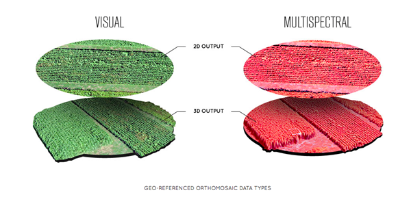
RALEIGH, N.C., Oct. 15, 2014 (GLOBE NEWSWIRE) -- Data Mapper, an enterprise aerial data software, today announced it will expand its cloud-based platform to ingest data collected by a wider network of UAV [unmanned aerial vehicle] providers. The application provides the ability to upload, store, process and share aerial imagery and is equipped for detailed, automated analysis.
Previously the company was known under the name PrecisionMapper and could only be utilized when collecting aerial data with the PrecisionHawk UAV platform, the Lancaster HawkEye Mark III.
"As we begin to collect data with PrecisionHawk UAV across data intense industries, we discovered a clear gap in the market for an end-to-end enterprise level solution," said Christopher Dean, CEO of Data Mapper. "The creation of Data Mapper was a way for us to ensure that what matters most to our customers, the ability to transform aerial data into actionable information, was available quickly and cost effectively."
The platform is accessible on numerous devices and allows a user to see data in real-time, long before a processed orthomosaic is available. Post processing is automated, and processed data can be shared across devices or analyzed using sophisticated algorithms. Data Mapper geospatial experts have been working closely with university partners across the nation to determine the most pressing algorithms for the agriculture industry such as plant height, weed detection, plant counting, canopy cover, among others.
Due to its early integration with the PrecisionHawk platform, Data Mapper has a strong client base that includes Fortune 500 companies, top global agriculture companies, education and research institutions and individual agricultural producers. Users of the application recognize the value in a streamlined data management solution that fosters collaboration.
As the UAV industry quickly expands, data intensive markets, like agriculture, can be equipped with a streamlined, information delivery structure that fits into an everyday workflow. Engineers have bootstrapped the technology to ensure seamless integration with workflows that rely heavily on accurate information to support business practices.
"UAVs are an extremely effective and efficient means for collecting data, but the value of this technology goes far beyond an aircraft," said Andrew Slater, VP of Software Development for Data Mapper. "Data Mapper is a tool designed to close the gap between a service that UAVs provide and the value of that service, which is information delivery to the right person at the right time."
The company has worked with data sets across a variety of industries including agriculture, oil and gas, emergency response, forestry, and insurance and will continue to extend their analysis capabilities to different markets. Data Mapper will significantly grow its employee base, hiring geospatial analysts, software engineers and embedded software engineers to work towards a generalized ingestion method for all UAV data in 2015.
About Data Mapper:
Data Mapper is an end-to-end enterprise aerial data management solution bootstrapped by the PrecisionHawk team in 2013 under the name PrecisionMapper. Data Mapper provides users the ability to store, process and share aerial data collected by unmanned aerial platforms. The cloud-based application is designed to process raw data and interpret that data into usable information in the form of actionable ortho-rectified, georeferenced mosaics in various 3D and GIS-ready formats. The company is headquartered in Raleigh, NC. To learn more visit online or visit Twitter @TheDataMapper.
Photos accompanying this release are available at:
http://www.globenewswire.com/newsroom/prs/?pkgid=28369
http://www.globenewswire.com/newsroom/prs/?pkgid=28370
Data Mapper Advances its Aerial Processing, Management and Analysis Software to Service Growing Network of UAV Platforms
The cloud-based platform will provide advanced analysis tools to convert aerial data into actionable information that will support better business practices
| Quelle: PrecisionHawk

